
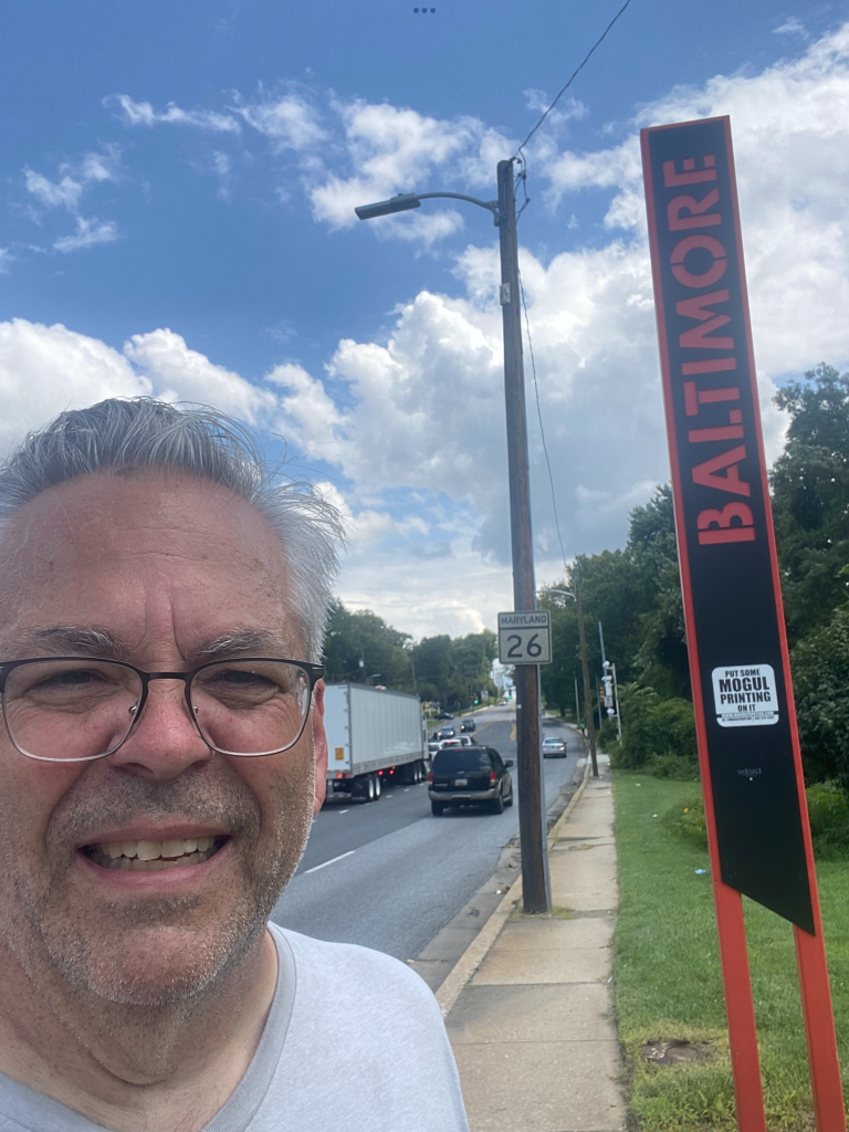
MY BELOVED ROAD MAP, as it appeared on February 1.

WHERE THINGS STAND – February 1

I am frequently been asked if I have an end date for this project? For months, I could only speculate. But now I have one. Monday February 12.
It’s hard to describe how I feel about that. It’s part excitement, part bittersweet. I look forward to completing the project, just as I look forward to completing any project.
But things have recently changed. Lately, my focus has (unfortunately) been on getting all of the streets completed. It’s been less about learning, exploring, experiencing. That’s what brought the joy.
But this had to eventually come to a (celebratory) end. I’ve spent the past 8 months running (jogging) a 10K every day. I’m not sure that human bodies are designed to withstand that but my body has allowed me to do it.
I’ll talk more about this at another time but there came a period when this whole project flipped. Originally, it was all about completing the map but it soon transitioned into getting to know every street. That was the true prize. Seeing people, waving at people, smiling at decorations, learning new neighborhoods, getting a better understanding of my city. Yes, my city. A city that seemingly or unknowingly embraced my neighborhood presence.
So, “see you at the end of Dark Lane.” Monday, February 12 at 1pm. It’s where Dark Lane meets St Paul Place downtown, next to Mercy Hospital.
Will there be confetti? Probably not. Will there be balloon animals? Probably not. Will there be some media? Maybe. Will there be somebody who just spent 8 months enjoying an amazing run? Absolutely.
One last thing, this image was taken today while I completed Roland Park. This was a post rehearsal run it involved a late afternoon sun. And it created some interesting shadows. I liked this one shadow. It reminded me of the female figure who was in center of the old Shop-Rite logo.
Sometimes the strangest things make you crack a smile.


YOU DON’T BELONG ON CHILDS STREET – February 3

There are plenty of nice and/or interesting places to run in this city but if you’re looking for a street in South Baltimore, I’d stay away from Childs Street. You don’t belong on Childs Street.
That’s what I was told by an armed officer in a special olive green uniform with patches.
It’s not that Childs Street isn’t a public road. It’s on the map and there’s no gate. It’s not even that interesting. Lots of fences, lots of warehouses, lots of Mercedes Benz cars.

But despite the flat dullness of the area, you cannot take photos of the flat dullness. At all. You must delete them before you get your lecture.
Since I had that lecture in my back pocket, I asked about Frankchilds Avenue. It’s on some maps. The olive green officer with patches said there was no such street. So like a crazy person I pulled out my phone and showed him.
He pointed to a barricaded road and said that must be it. But I had to stay away from it. I asked if I could put one foot on the street to say that I was on Frankchilds Avenue. I was told I would be quickly met with armed guards. (When I got home, I pulled out my Liquid Paper and blotted Frankchilds Avenue off my road map. So there.)

Am I shaken up by this? Hell no. It was fine. It was just one more piece of my ‘run every street’ story.
I did get to hit a few other strange industrial streets without confrontation. I happily crossed off Coal Pier Road and Little Market Street, among others.


I also crossed off and finished up roads within the Cherry Hill Homes and Westport Homes public housing complexes. And that’s where things became amusing. I’ve been told over and over to be careful, avoid certain sections of the city. I didn’t belong there, they were too dangerous.
But here I was respectfully running through public housing developments without any incident. And after 8 months, the only place I haven’t belonged in all of Baltimore is Childs Street.

ONE WEEK AWAY – February 5

It’s true. It’s real. I’m one week away from my finish line, a finish line I never expected to have. I’m happy, sad, nostalgic, relieved, proud, and bewildered that this project will end.
Some questions you may have is “how is this even possible? How could you run the city in slightly more than 8 months? You must be lying. I don’t like you.” (I add that comment for drama.)
I never hid my strategy. Never run a street more than once. Always (over)study the map and squeeze out every geometry skill you may have left in your brain. You can figure out ways to maximize your road time. And most importantly, every time you put your running foot on the road, it must, as much as possible, be on new un-run asphalt.
Now, do remember that when I set out to do this last July, I had already been running for 13 years, without missing ANY day. When the idea for this project came to be, I bought a trusty detailed road map and marked off streets that I 100%, no doubts, knew that I had run on over the past 13 years. It was less than I thought, suffice to say. I had my customary routes in the city, that’s how I grew bored.
I realized that this city is built on spokes that radiate from downtown. So I hit the main streets, headed toward the county lines, and started to create some type of puzzle. And over time, each puzzle piece contained about 5-8 miles of roadway. That’s was the formula. Make puzzle pieces, fill them in.
So here are images of my map/puzzle over the past 8 months. The first one stems from the time I initially marked off my 100% known roads. I really haven’t been on those roads in 8 months. So in some ways, it’s time to come home.


GETTING LUCKY – February 6

I couldn’t believe it when I found this little green foam clover on Wesley Avenue. It was a total game changer. A milestone.
You see, the temperature was well into the 90s when I started this whole thing on July 6. My runs were usually in the morning and my clothing often became saturated in sweat.
But over the past 8 months, I’ve seen so many seasons without looking for them. It’s one thing to drive in a car and notice things, and I have absolutely nothing against that. But it’s another to be out in the open while your eyes take in the sights, and seasons. Every day on every street.
Here we are in February and I’ve wondered if I could finish this project before I saw a St Pattys Day decoration?(Baltimore loves to decorate.) I’m not sure if I wanted to, or not but that all changed today. I found my lucky clover, and it made me so happy.

OTHER MILESTONES:
First Halloween display – September 11
First need for a jacket – October 18
First real fall foliage experience – October 23
First inflatable Thanksgiving Turkey – November 2
First Christmas display – November 15
First Valentines decoration – January 11
First green clover – today


I only have 6 days left until I finish this. Will I get by without seeing an Easter decoration? I’m not sure if I want to, or not.

UNFORGETTABLE – February 8

The term “unforgettable” refers to the picture above, taken during today’s run. I’ll get to that in a bit.
I believe that everything needs a deadline in order to get done and I’ve been really pushing my body in order to meet that self-imposed deadline. I’m at the point where I’m ready to say that I did this.
I started today’s run rather forgettably, I had to cross off a number of streets in an industrial park near Fort Holabird. Uneventful but it had to be done. It was what it was.


Then it was off to finish up Highlandtown, always an interesting place. Every street tells a story, and besides, I couldn’t pass up the opportunity to run on 5 and 1/2 Street. (The loose pit bull added some anxiety but I’m good with dogs. Famous last words.)


But as I’m wrapping up Esther Place I notice two men engaged in conversation on the sidewalk. I wonder what they’ll think when old me comes chugging along? So I do what I always do, I wave and say hello.
They did the same but then I heard “you’re the guy I saw on TV!” I didn’t know what to think but I was shocked. The only thing that followed were big smiles.


Byron told his friend about me and Byron seemed to remember that report better than I did. It was so great. I learned about his son who loves his Highlandtown school, where he gets As and Bs, and I responded to a question and told them I’ll turn 60 this year. That really got them.
What I want to say is that I wasn’t sure how these two men would expect this old guy running through little Esther Place. I wasn’t sure what we’d have in common. But we had plenty in common, including a smile, wave, and kind words. And an honest willingness for a connection.
There are just a few days left until I reach my finish line but days like these, meeting men like them, make me feel so fortunate and lucky as I learn and discover my city.
SHOUT OUT – February 9

I want to give a quick ‘shout out’ to my partner-in-crime, my 2017 Honda Fit. It’s been at my side, like a loyal pet, and has spent hours in bizarre places. If this car could talk, I could only imagine the stories it could tell.
I guess the car is well conditioned. It’s spent its entire life on the streets of Fell’s Point. It’s been dinged, it’s been rummaged through too many times and it’s out right filthy. But it’s helped taken me to places that some cars may not want to go.
Good car.


COUNTY LINE – February 10
People frequently ask me if I have a favorite route? I really don’t have a favorite because that means that I might have a least favorite. I really took something away from all of them and keeping positive has kept this whole thing alive.

I will say that some of the most satisfying routes, as far as this project is concerned, are ones that take you to a county line. It gives you a sense of accomplishment and it makes your map look really good as you mark off Liberty Heights Ave, York Road, Belair Road, and many others.


I did learn that Baltimore is almost designed as a big bicycle wheel. The historic center of the city is at Baltimore and Charles Streets and those main bicycle-spoke streets radiate from downtown. Usually at an unending incline. Unfortunately. (I’m talking about you, The Alameda.)

It’s also really fun to find that exact county line. It’s relatively easy on Harford Road or Eastern Avenue but what about the small streets? The very small streets? You learn. You look for changes in pavement, street sign fonts, sidewalk locations. Even trash can markings give clues. It’s all part of the fun.


But it’s often very easy to locate the Anne Arundel county line. I learned that early on. Many of the small streets in Brooklyn and Curtis Bay have major highway-styled ‘Welcome to Anne Arundel County’ signs. They read less as a greeting and more as a warning that you are not our responsibility. That may sound harsh but it sticks with you once you see them.


Another reason I like finding the county line is that I don’t want to go past it. That’s wasting time but most importantly, wasting my feet. And to those who saw me go past the Violetville-area county line back in September, I’m sorry.
IRVINGTON -February 11


If you want to read about my final neighborhood, go to the home page for the separate entry on Irvington. A great final neighborhood with some great people. And church bells. A great way of sign off and get even closer to the end.
AND THE REST… – February 11

After a wonderful time in Irvington, I had to do some cleanup. It was kind of like moving out of an apartment. It was time to cross off the remaining streets on the map. For one reason or another, they were left unmarked over the past many months. So here they are.
BLOOMFIELD AVENUE

I guess I thought that Bloomfield Avenue was just an entry into a Royal Farms. It’s not. It’s located near Caton and Benson in SW Baltimore. It had to be run, especially since there’s a house on it. No excuse.
MAEMPEL LANE

Maempel Lane is near Frederick and Franklintown. It’s small and relatively battleworn. It’s in a hard area. I likely passed over it because it can be fairly active. Sometimes it’s best not to look like an intruder, or appear lost and confused. Today it was quiet.


S. BRUCE STREET

There was this small section of Bruce Street, just off Eagle Street, that needed to be run. I don’t know why I passed it over. It would’ve been part of an earlier run and I likely thought it was an industrial center entrance. Never assume.
ERICK STREET/JORGENSEN ROAD

I did run some of Erick Street before but I stopped. I thought it was gated off. It’s easy to see a street on a map and learn, on site, that it is no longer public access. Never assume. Located in Cherry Hill, it does provide a nice downtown view.
I was expecting to run on its connecting road, Jorgensen Road, but it seemingly changed names. It’s now called Metal Lane! Beautiful! I can add this to my collection of favorite street names. I’ll file it under the Chemicals and Materials selections.

VIONA AVENUE

I’m sorry but I don’t have much to say about Viona Avenue. It’s just off W. Patapsco Avenue and looks more like an industrial drive. But it’s there and it’s named. I have no choice. And as a bonus, it’s located alongside a very questionable crab stand. I couldn’t tell if it was open or closed down.
ELSINORE AVENUE AND ALLENDALE ROAD


Now I’m not talking about all of Elsinore or Allendale. I’d still be out there. I’m just talking about these two segments between Windsor Mill Road and Gwynns Falls Parkway.
I have no idea why I didn’t run them before. But I just have to trust my map. And I’ve learned not to question my map. It’s been right most every time and its accuracy continually impressed me.
BONNER ROAD

I had this policy to not running in areas that said “Private Property” or “No Trespassing” but I ended up changing it over time. You can visit and not trespass. It involves not disturbing but respecting. Pass through, not trespass.
BEAUFORT AVENUE


I know why I passed up Beaufort Avenue, between Belvedere and Hayward. It’s a hard area. There are a lot of struggles and issues in this part of Arlington and I decided to pass on it many months ago. So I returned today. It’s still a hard area but I felt more comfortable. I’ve learned a lot over the past many months. I knew it would be OK and it was.
STONY RUN LANE

It’s kind of odd going from Beaufort Avenue to Stony Run Drive but it can be done. Guilford is very different from Arlington.
I don’t know why Stony Run Drive, along with portions of Stoneyford Road or Linkwood Road, were not crossed off before. I’ve been in that area before but I must trust my map.
ENGLE AVENUE/ WYANOKE AVENUE


There were these two little segments, just off Greenmount Avenue, that were not marked off. I worked hard in that corridor a number of months ago. Old York Road can be quite confusing. Streets are not necessarily straight and are often in segments. This was another case of having to trust my map.
N. CURLEY STREET

I’ve been eyeing this little blip of N. Curley Street, just north of Madison Street, for weeks. It’s a dead end street with a huge pile of broken concrete at its end. When the light hits it in the late afternoon, the sight is unreal. Almost beautiful, at least by car. I kept putting it off, hoping for that perfect picture. Today it was now or never, and dreary. Oh well. You can’t have everything.
HOLTZMAN COURT

This one’s the kicker. I can almost hop on one foot from my house to Holtzman Court but I never noticed it until just a few weeks ago.
It might be Baltimore’s narrowest street. It’s amazing. It seems alive and is its own little enclave. Where have I been? I almost feel ashamed to live here for 20 years and never notice Holtzman Court. I should make myself hop there as punishment.


